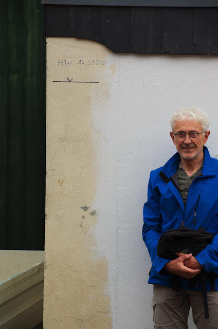
A very large number of villages were affected by the deluge. I was personally affected by maybe 5 villages . two: Euskirchen and Kuchenheim, I won't be describing - but of the other 3, it is now the turn for Sötenich.
This sign is typical of the efforts to rebuild in countless communities. The kilometers are from Köln/Cologne and Sötenich is about half way to Trier.
The stream looks innocent.
And largely it was - it was the volume above the ground that could not flow away.
Waterfalls "happened"!
This just "happened" out of the hillside at the top end of this road.
Note the red truck on the left. I shall do a sequence ending up this road near the top right building looking back down:
The flooding here represents a huge volume - can you imagine all of Lake Simcoe and Couchiching watersheds? North of Oakridges Moraine? North of the GTA?
The Romans worked very hard to get the water from Grüner Püz out of the Urft watershed into the Rhein valley - that river is some 50 - 70 km East -
The photos I took were not far from the bridge crossing the Urft in the upper left on this map.
Some during and after photos from the Sötenich web site:
I saw this little engine - used, I think, in the lead mines. It is so massive/compact/dense that
it did not move in the flooding.
Neither did a piece of aqueduct move - it had been and is still - on display near the bridge.:
My friends lived up the hill from this stream, the Urft, but still found the water more than ankle deep on the hill side during that night. When we melt the glaciers of Greenland, the Himalayas, and Antarctica, we shall see how water backs up - and backs up rivers, too.
I'll take a break before tackling my local "it can't happen here" problem. We know the answer: yes it can! But we need to remember this every day. Remembrance Day is not just November 11 in some societies, is it? And wear an Orange shirt, too.
WOB


No comments:
Post a Comment